Sorry folks. Apparently Blogger can't handle Photos on the Mac. Gotta figure out the upload situation.
It was in the low 60s and sunny when I headed out from Salt Lake City on my Harley Street Glide touring bike I picked up from Eagle Rider. Blue skies and pillowy white clouds. I could see dense black rainclouds clearly dumping in the distance. After about an hour, just as I turned off the highway for lunch, I was hit by a downpour complete with small hail pellets. After a half hour at Subway, blue skies returned and I was back on the road.
Dusty olive green landscape charged up mountains on both sides as I steered down the highway 15 valley, then from Nephi to Highway 28 through Selina, to Highway 24 towards Torrey and Capitol Reef National Park. Amazing snow capped mountains in the distance kept me company as the bike charged down the highway feeling like a Cadillac but sounding like a steam-powered locomotive.
The rain came down hard in Gunnison, challenging my vision as it soaked the road. At the 24 turnoff the rain abated and the landscape suddenly transformed into sandy brown rolling hills dotted with brush. Despite multiple signs warning of elk and deer keeping me on the lookout, the only thing I came perilously close to was a cow munching beside the road.
It rained on me for about another half hour as the temperature sank to the mid-40s over the 7,200 foot pass near Lyman. More hail. Got to the Best Western, set against red rock cliffs. Dinner at a killer Southwestern restaurant, reportedly best in the state, called Cafe Diablo. Rattlesnake cakes for an appetizer with rosemary aioli was tasty, but the tamale I was craving came bland and mushy. Boo.
After dinner the light was beautiful so I decided to drive into Capitol Reef Park, where I was not disappointed. The magic hour for photo light was perfect, so I snapped a few pics and headed to the hotel by 9 pm.
Tuesday, May 24, 2011
Friday, June 25, 2010
Continental Divided
Six hundred sixty miles Wednesday and Thursday took me over, you guessed it, more passes and more Continental Divide crossings. Alternating between long haul drudgery, spectacular vistas and stay-on-your-game, narrow roads full of blind corners, this ride offered some of the best - and worst - roads of the trip.
 I decided to haul it out of Durango Wednesday morning. The Best Western wasn't centrally located, and though I would have liked to have visited Mesa Verde, it was a half day trip minimum and motorcycle boots aren't made for hiking. I didn't really want to drive all the way back to Denver from Durango in a day anyway, and the purpose of this trip was to ride. So I looked at my map and made a plan to ride through Rocky Mountain National Park about 400 miles north. Bye bye Durango.


 I decided to haul it out of Durango Wednesday morning. The Best Western wasn't centrally located, and though I would have liked to have visited Mesa Verde, it was a half day trip minimum and motorcycle boots aren't made for hiking. I didn't really want to drive all the way back to Denver from Durango in a day anyway, and the purpose of this trip was to ride. So I looked at my map and made a plan to ride through Rocky Mountain National Park about 400 miles north. Bye bye Durango.
I really loved the 80 miles of Highway 550 between Durango and Ouray, called the "Million Dollar Highway" for the millions in silver extracted along the route, when I rode it on Tuesday. The section between Silverton and Ouray that winds through a narrow, red rock canyon along a river was most spectacular. In fact, I'm calling it my favorite road of the whole trip. So I took it again, but this time kept going through Montrose, Delta, Paonia, Carbondale, Aspen, and Twin Lakes, finally pooping out in Leadville on the other side of the Rockies.
Not much to take pictures of til I got to the top of Independence Pass and crossed the Continental Divide again. The road from Aspen to Twin Lakes over the pass is my second favorite road of the trip. Narrowing in one lane in some places and full of blind corners, I tooted my horn before many turns to warn oncoming cars of my approach. A lady in a sun hat and a little red MG nearly took me out.
Situated above 10K ft, Leadville is the highest elevation town in Colorado, I stayed at the very historic Delaware Hotel, which I was sure would be haunted by the looks of it. Alas, no sightings. Leadville is remarkable for the $7.95 filet mignon dinner at the Quincy restaurant, which gives diners only one menu item to choose from each night of the week.
On to RMNP on Thursday, my final day of the trip. I went over Loveland Pass almost by mistake after missing my exit in Dillon, but was glad for the pretty diversion. Finally made it to the visitor center around noon, and was told there was about 20 miles of road construction on the road through the park. Single lane, many delays. Eighty five degrees. No thanks. My rule is, if it ain't gonna be fun, I'm not doing it. Headed back the way I came in, only to find the road blocked by the fire department working on a roadside store on fire. Trapped, I waited it out for an hour in the western-themed (what isn't here?) town of Grand Lake.

Finally on the road again around 2:30 p.m., I headed over Highway 40 and Berthoud Pass, my final pass over the Continental Divide. An hour later I was back at Clint & Karen's house in Denver. Another year, another trip complete!

Tuesday, June 22, 2010
Passing Out

 I cruised up Colorado Highway 550 through Silverton (kind of a dud), Ouray (cute!), Telluride (really cute, but too many touristas), and back to Durango, racking up 250 miles on the odometer. The two-lane twister took me past the Red Mountain mining region, home to numerous historic mines with names like Virginia Girl and Idorado. The area made a lot of folks ridiculously rich in the late 1800s, and is, in fact, where the Guggenheim family wealth originated. You can't see it very well in the photos, but the mountains are very very red.
 Ouray retains its Western charm, but has a more progressive feel than Silverton, which was run down and looking like it was on its way to becoming a true ghost town. In Ouray workers were busy remodeling buildings, the outdoor Hot Springs was bustling, and the Mouse Coffee and Chocolate store was expanding into the space next door. Go mouse!
Telluride was the biggest tourist trap of them all, with lots of contemporary condos, restaurants, shops, and outdoor outfitters ready to serve the weekend warrior's every need. It took the cafe forever to serve my tuna salad, and I couldn't wait to leave after an hour.

Stopped for a photo at Lizard Head Pass, elevation 10,222, peeled off my jacket around Dolores, and made it back in time to visit Harley Davidson of Durango for the souvenir T-shirt.
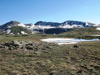
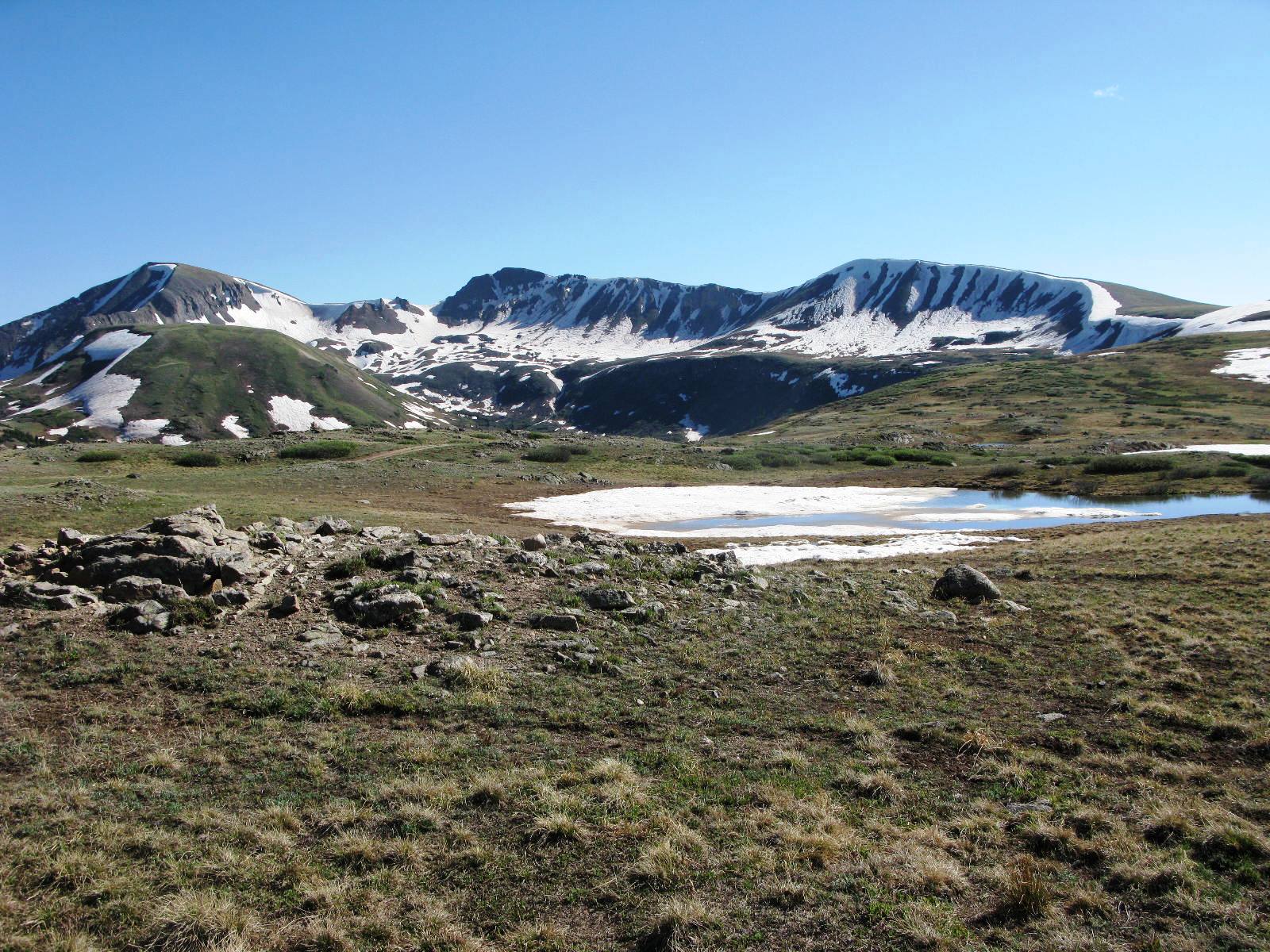
Along the entire ride I was struck at how absolutely green the mountains were, some rising more than 14,000 feet, all sloping down cleaving valleys in between. One after another after another.
Birds spotted: Willow Ptarmigan, Sharp-shinned Hawk.
Tomorrow gettin' outta here and heading towards Aspen.
Monday, June 21, 2010
Oh Give Me a Home


Made two passes across the Continental Divide at Spring Creek Pass and Wolf Creek Pass, both more than 10,000 feet. Now, when you're on a motorcycle, you tend to sing songs to yourself quite a bit. So all day it was "Wolf Creek Pass Way Up on the Great Divide Truckin on Dowwwwwn the Other Side." :) Yeah, the air is thin up here.
Despite the fate of CW McCall's load (crashed the cluckers at Pagosa Springs), Wolf Creek Pass might have been the most scenic part of my trip so far. Lots of wind, but nice winding roads and little traffic.
Glad to have passed on by hot and dusty Pagosa Springs to stay in cute Durango, where it's nevertheless a toasty 88 degrees. Naturally I'm wearing full body black, topped with a nice thick helmet. I've got my own personal sauna!
 Oh, about that marmot. The incident happened near Spring Creek Pass. I saw him in the grass, heading full throttle towards the road. He had something in his mouth. A pine cone? I was doing about 55. Surely he would see me. Surely he would hear me. But he'd committed. Head down, eyes forward, he dashed. Do I speed up? Do I slow down? We were on a fast-paced collision course. I released the throttle and swerved. My heart leapt into my throat. Missed his tail by an inch. Marmot lives to see another day.
Heading out to find some good Colorado BBQ. Tomorrow the Ouray/Silverton loop, one of the most fabled motorcycle loops in the country.
Sunday, June 20, 2010
Denver to Gunnison, and then Some


First day riding my rented Harley Street Glide FLHX, and what a big day it was. Three hundred fifty miles from Denver, past Gunnison, all the way to Black Canyon of the Gunnison National Park, then 70 miles backtracking to Gunnison. Riding companions John and Beth did a superb job guiding me on their BMW R1200 in hot, sunny weather under blue skies. Rode over the Cotinental Divide at Monarch Pass, 11,312 feet, after gliding over Kenosha Pass, 10,000 ft, and Red Hill Pass, 9,993 ft. The came Black Sage Pass at 9,475 ft. A day full of winding roads, craggy pinnacles, countless mesas, and looming green mountains that have already lost most of their snow
Along the way we took in miles of pasture land populated with the requisite sheep, cows and horses, while turkey vultures, darting wrens, and red tailed hawks soared above. Closer to the highway were six deer carcasses and one smoking frame of a motor home that had been fully engulfed in flames. Talk about vacation gone wrong.
Moving on, Black Canyon of the Gunnison became a National Park in 1999, and is spectacular for is bottomless depth and dramatic rock cliffs. Well, it's not bottomless, but at 2,700 ft straight down, it's far. A curvy road skirts its south rim, and the visitor center, with requisite National Park Service film, souvenirs, and a terrific view, sits on the edge of the canyon.
Tomorrow it's breakfast then heading south over Wolf Creek Pass, made famous in the CW McCall song of the same name. "Me an' Earl was haulin' chickens On a flatbed outa Wiggins And we had spent all night on the uphill side Of thirty seven miles of hell called Wolf Crick Pass..." Wish me luck!
Sunday, June 6, 2010
Making a List - what to pack for a ride thru the Rockies? All the lists I've found are for men. One suggests I bring a Glock and spare cartridge, along with condoms and a stripper preparedness kit. What do you suppose one should bring in the event one encounters a stripper on a Rocky Mtn roadside? Spare pasties?
Tuesday, July 14, 2009
Ever Been to Palouse Falls?

A long, long time ago icy lakes melted and froze, melted and froze. When they did, they sent huge walls of water across the Northwest, causing what are called the Missoula floods. The Missoula floods changed the landscape by carving canyons and making new rivers. Some of the rivers were so big they made waterfalls way bigger than Niagara Falls. There are a few dry falls around the Northwest from the floods. This one isn't dry. Palouse Falls is about 30 miles north of Walla Walla. Nice little park there, and trails to the falls if you have the time. Best in the fall, I think, or early in the morning. Bloody hot in the
 afternoon in July. Sally and I took pictures then walked really fast back to the car and turned on the air conditioning.
Subscribe to:
Posts (Atom)